Ocean/Sea Ice: Assimilation Setup: SSS
 Sequences 1 and 2 constitute a constraint by the WOA09 climatology of T and S. The reasons for using this constraint are two-fold: (1) to force the model to a reasonable climatology, and (2) to correct for unrealistic fresh water fluxes and runoff by assimilating SSS. Because of the relatively high resolution of the WOA09 climatology (1 degree horizontally and 40 levels vertically), the spatial scales imposed are quite small (line 1 of Table 1) to reduce the computing cost of the first assimilation. The inflation factor was adjusted through trial and error until a realistic climatology was obtained, while the variance of the system was still acceptable. The observational error variance was set to be 100 times the relevnat diagonal element of P. The parameters for the assimilation of SSS are given in the second line of Table 1. Only 10% of the SSS climatology data points, randomly selected, are included per assimilation window. The horizontal scales and inflation factor were also adjusted through trial and error with a similar target as for the assimilation of climatological profiles. The vertical influence of the SSS observations is limited to 100 m or the depth at which the salinity difference is 0.5 from the background at the surface, whichever is the shallowest. Figure 3 shows the observation error (the square root of the diagonal of R) used for SSS. It was estimated by calculating the mean difference between WOA09 and Argo surface salinity in 1-degree bins over a period of 8 years (2003-2010). The observation error was reduced in regions of large runoff to 0.001. 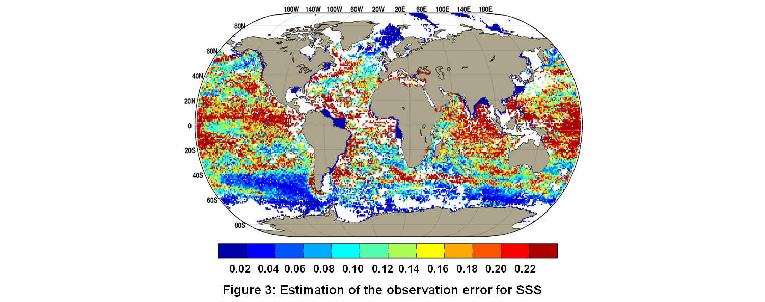 |