Initialization: Weakly Coupled Assimilation: Model Configurations
 The Goddard Earth Observing System Model, Version 5 (GEOS-5) Atmospheric General Circulation Model (AGCM) has two configurations, differing from one an other only by the inclusion or exclusion of the atmospheric component. Configuration 1 (CM1) is a fully coupled model that integrates the Fortuna version of the GEOS5 AGCM with:
The atmospheric model uses a Cartesian grid with a 1° × 1.25° horizontal resolution and 72 hybrid vertical levels with the upper most level at 0.01 hPa. The nominal resolution of the ocean grid is ½°, with a meridional equatorial refinement to ¼°. It is a regular Cartesian grid south of 65°N, and curvilinear north of 65°N, with two poles located on land to eliminate the problem of vanishing cell area at the geographic North Pole (Figure 1). The resolution of the resulting tripolar grid is depicted in Figure 2, which shows the square root of cell areas in units of kilometers, with a minimum and maximum resolution of 15 km and 52 km, respectively.The ocean topography is derived from the ETOPO5 data set. The CM1 framework has been used in support of the decadal prediction activities under the Coupled Model Intercomparison Project Phase 5 (CMIP5; Ham et al. 2012) as well as the GMAO seasonal forecasts that are contributed to the National Multi-Model Ensemble (NMME) project. 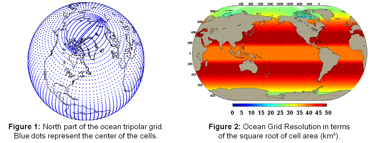
Configuration 2 (CM2) is similar to CM1, except that the data-atmosphere module of GEOS-5 is used so that surface forcing from the atmosphere is prescribed. The skin layer is provided with specified hourly fields of:
|