
7km GEOS-5 Nature Run Mesoscale Convective Complexes
A mesoscale convective complex (MCC) is a large thunderstorm complex easily observed as cold cloud tops in infrared (IR) satellite imagery or outgoing longwave radiation from models. These large clusters of convection can be identified as continuous areas of cold IR brightness temperatures cooler than 225 °K (-48 °C) or outgoing longwave radiation (OLR) less than 150 Wm-2, with surface areas larger than 100,000 km2.
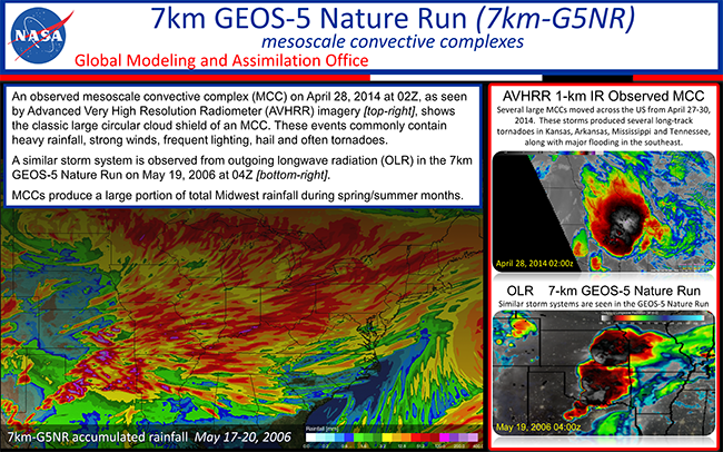
While MCCs occur globally, primarily over land, they are well known to be severe weather producers across the central United States (US) during spring and summer months. In the US, these complex nocturnal clusters of thunderstorms typically form over the eastern slopes of the Rockies and travel eastward across the Midwest maintaining their structure and intensity over long distances. Their development is driven by temperature and moisture advection from a strong low-level jet, typically forming along a weak shortwave trough or surface front. The environment for MCC development typically persists for several days, producing multiple MCCs across the central to eastern United States. These systems commonly produce heavy rainfall, strong winds, frequent lighting, hail and often tornadoes. MCCs are responsible for a significant fraction of the May-June-July total rainfall in the Midwest.
Global models typically struggle to resolve these systems leading to substantial rainfall deficits in spring and summer totals from May-July across the central US. The 7km GEOS-5 Nature Run has demonstrated a substantial improvement in the capability of global mesoscale models to simulate these MCCs.