

GeoXO Promises NWP Modeling Breakthroughs
Following the launch of the last GOES-R satellite in June 2024, NOAA and NASA are working together to develop the next generation of geostationary satellites, the Geostationary eXtended Observations (GeoXO) constellation. As part of this technological advancement, the GeoXO program will include a new central satellite with a new payload for the United States, set to launch in the mid-2030s.
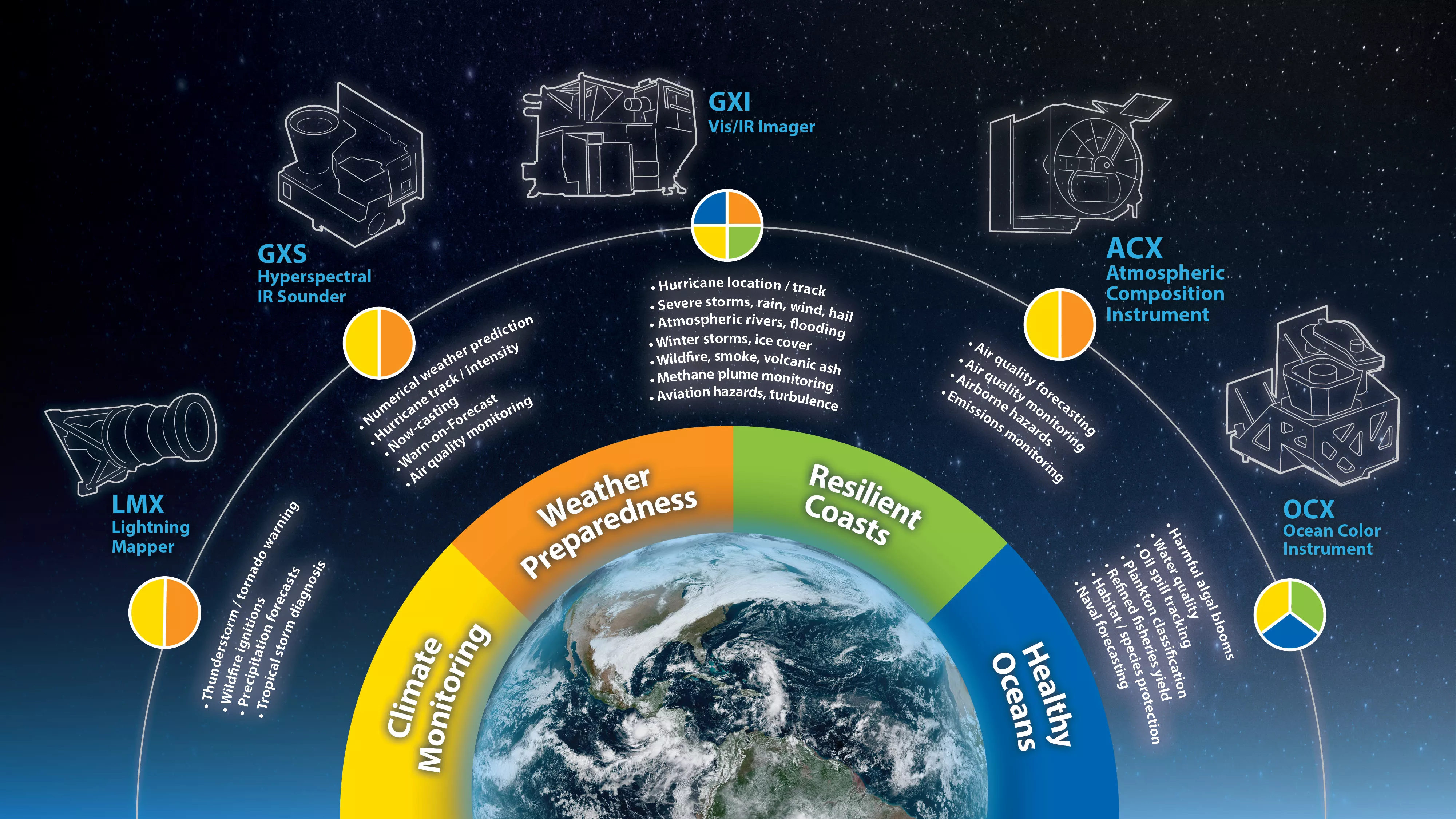
The GeoXO Sounder (GXS) is a hyperspectral infrared sounder that will scan the Western Hemisphere scanning disk in 30 minutes or less. As a hyperspectral sounder with a nadir footprint of 4km, GXS will provide high resolution horizontal and vertical information on temperature, water vapor, and trace gases throughout the atmosphere. Combined with the high temporal refresh provided by a GEO platform, GXS will continuously monitor regions relevant to US weather, seeing gaps between clouds and the development and evolution of high impact weather processes.
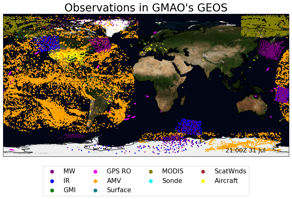
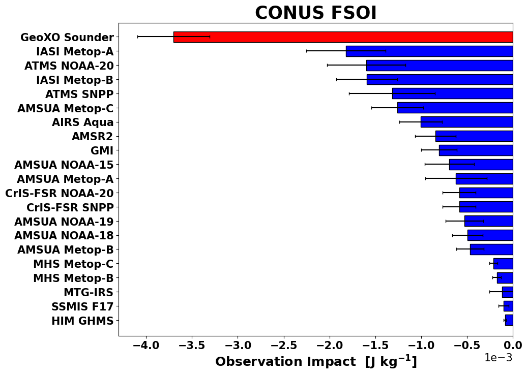
The GMAO is well poised to take advantage of these much-needed data as efforts are already underway to prepare the GEOS DAS to assimilate these data through work using the GMAO observing system simulation experiment (OSSE) framework. Prior work has shown significant improvement to hurricane forecasts when geostationary IR sounder data are assimilated and the GMAO is at the forefront of this research.
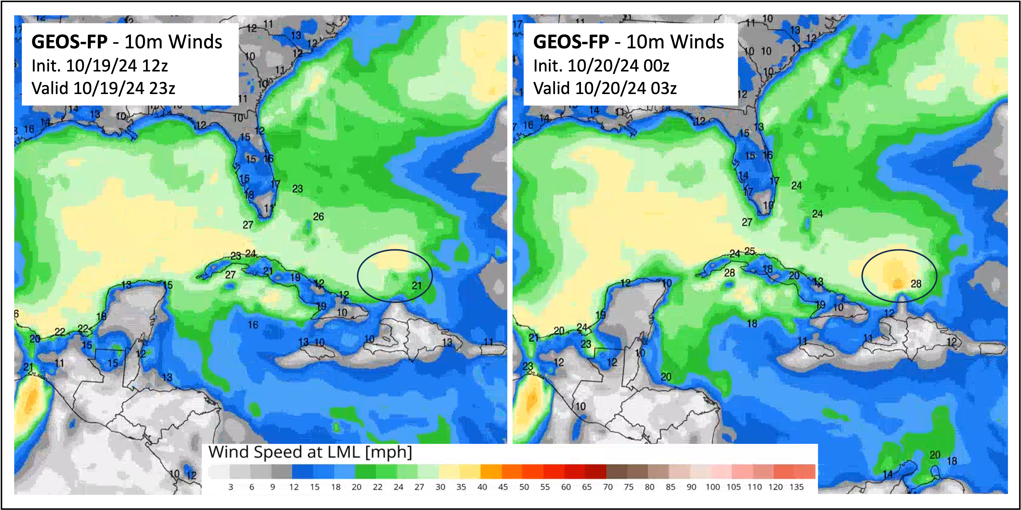
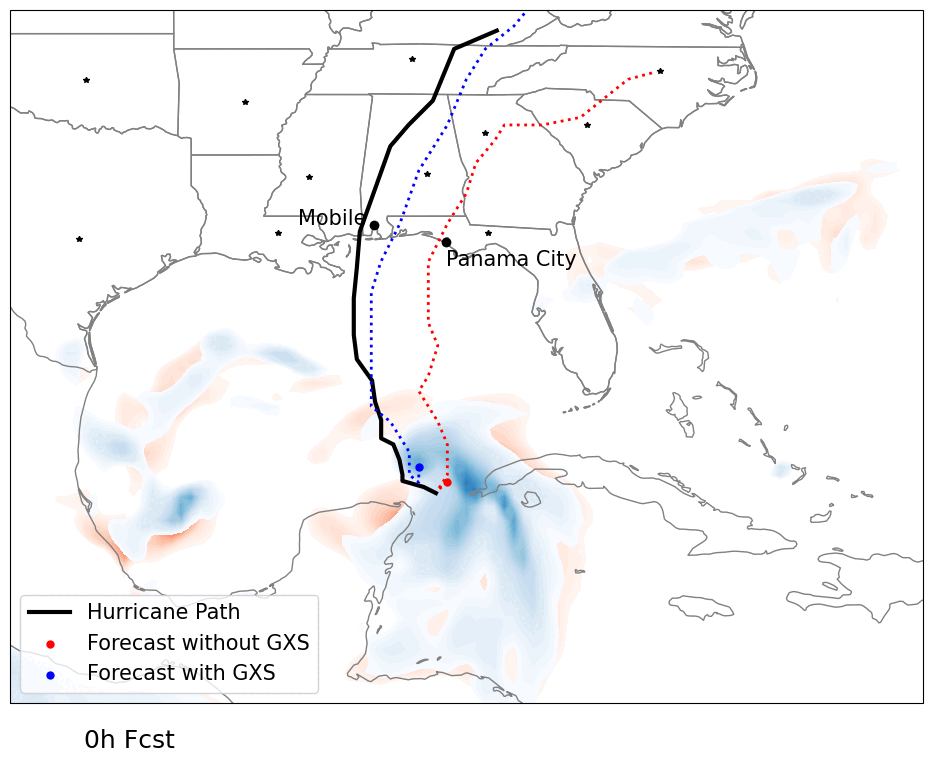
One recent example where GeoXO would have made an impact can be seen in Hurricane Oscar this past October. The smallest storm on record in the Atlantic basin, Oscar was too small for even the 0.25-degree GEOS-FP system to detect, if not for a LEO satellite that happened to pass overhead at the time of peak windspeed (Figure 3). Improved resolution of GEOS-FP provided by GeoXO's next-gen instrumentation would have allowed this storm to be resolved. Improvements to GEOS forecasting via GeoXO can be seen in the hypothetical hurricane forecast above, which plotted a simulated hurricane using existing (red) and GeoXO (blue) observational data.