

Tropical Cyclone Akará Brews Near Brazil
A rare tropical cyclone formed in the South Atlantic - just as NASA's flagship NWP model predicted. Explore how GEOS-FP forecasted this unusual event.
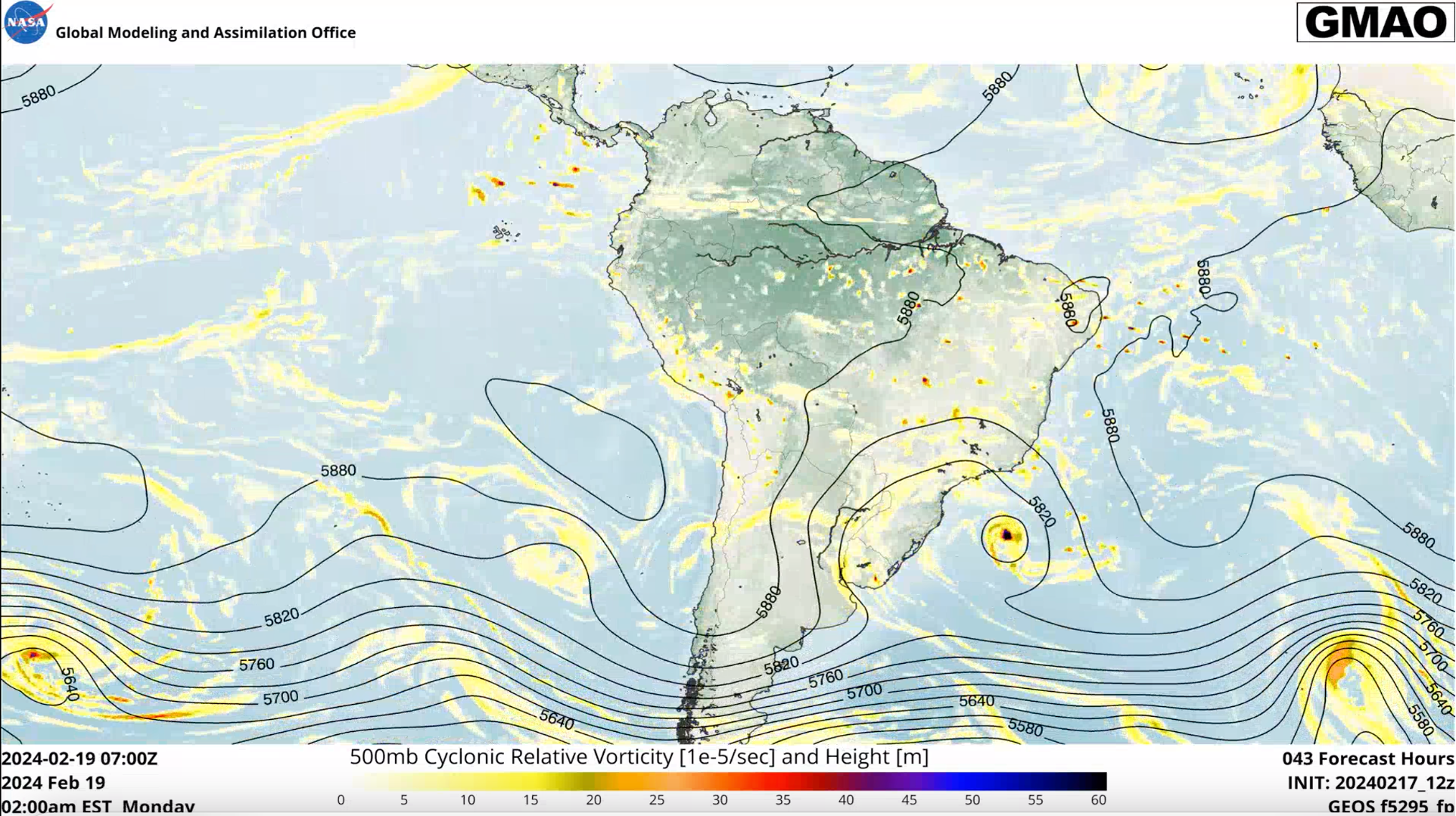
The hallmark of a good numerical weather prediction (NWP) model is its ability to consistently provide accurate forecasts, especially ahead of unusual or high-impact weather events. Recently, NASA GMAO’s flagship NWP model, GEOS-FP, successfully did just that when it called for something unusual taking shape off the southeastern coast of Brazil. NWP models of just ten years ago could not have forecasted such an event. Consecutive GEOS-FP forecasts starting Feb. 15 indicated low-pressure would form in that area of the South Atlantic basin in about two or three days. While that’s not unusual, GEOS-FP accurately anticipated that this system would take on characteristics of being symmetric and warm-cored. In other words, a tropical cyclone. And, late in the day Feb.18, NASA satellites along with ocean surface wind scatterometry (ASCAT) indeed confirmed the presence of a South Atlantic tropical cyclone.
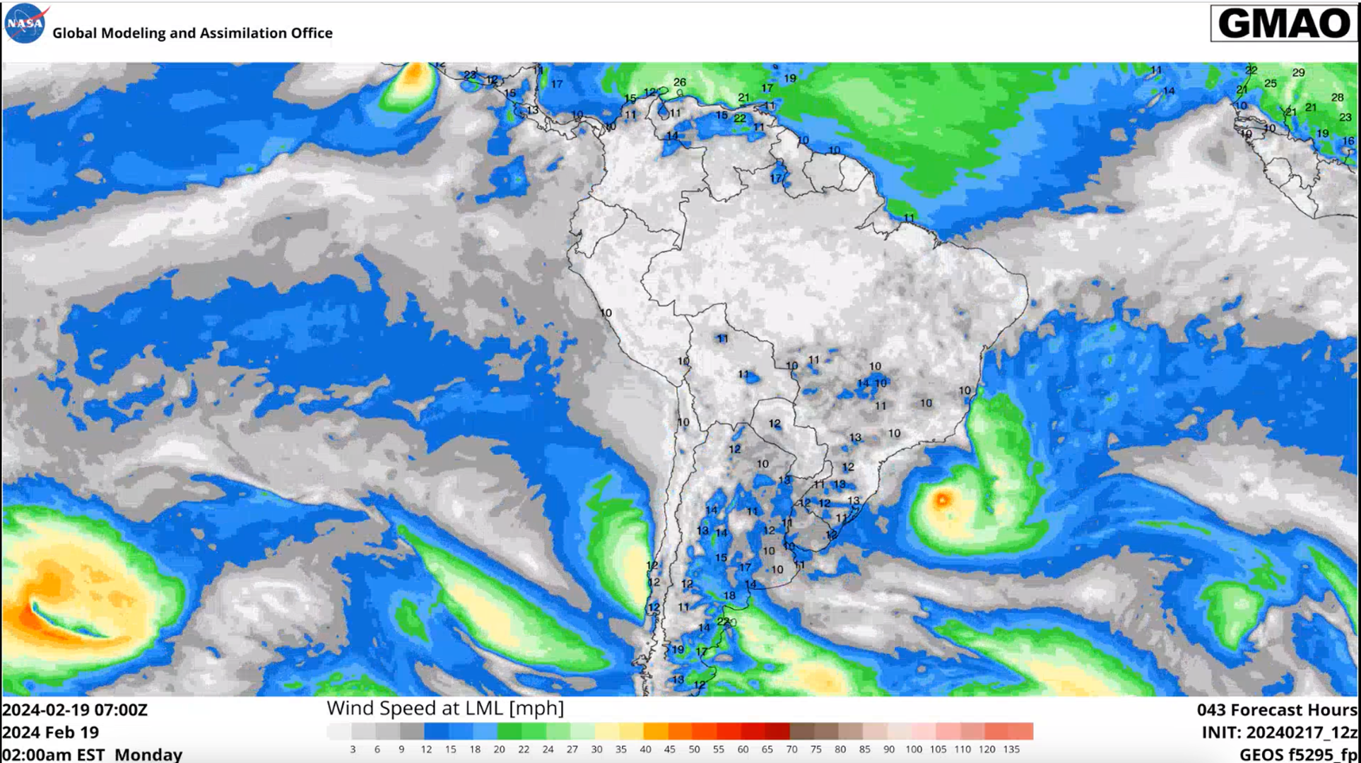
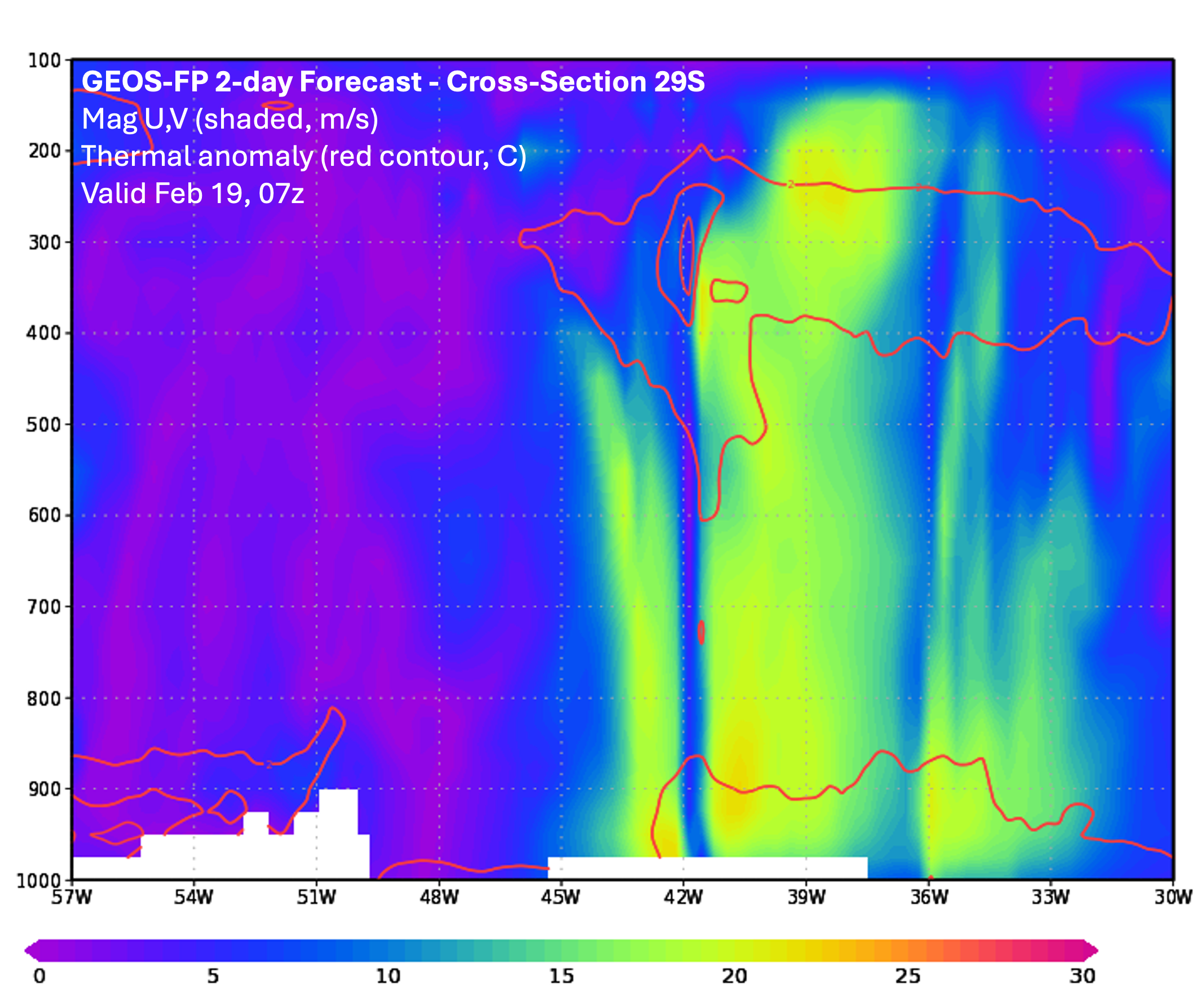
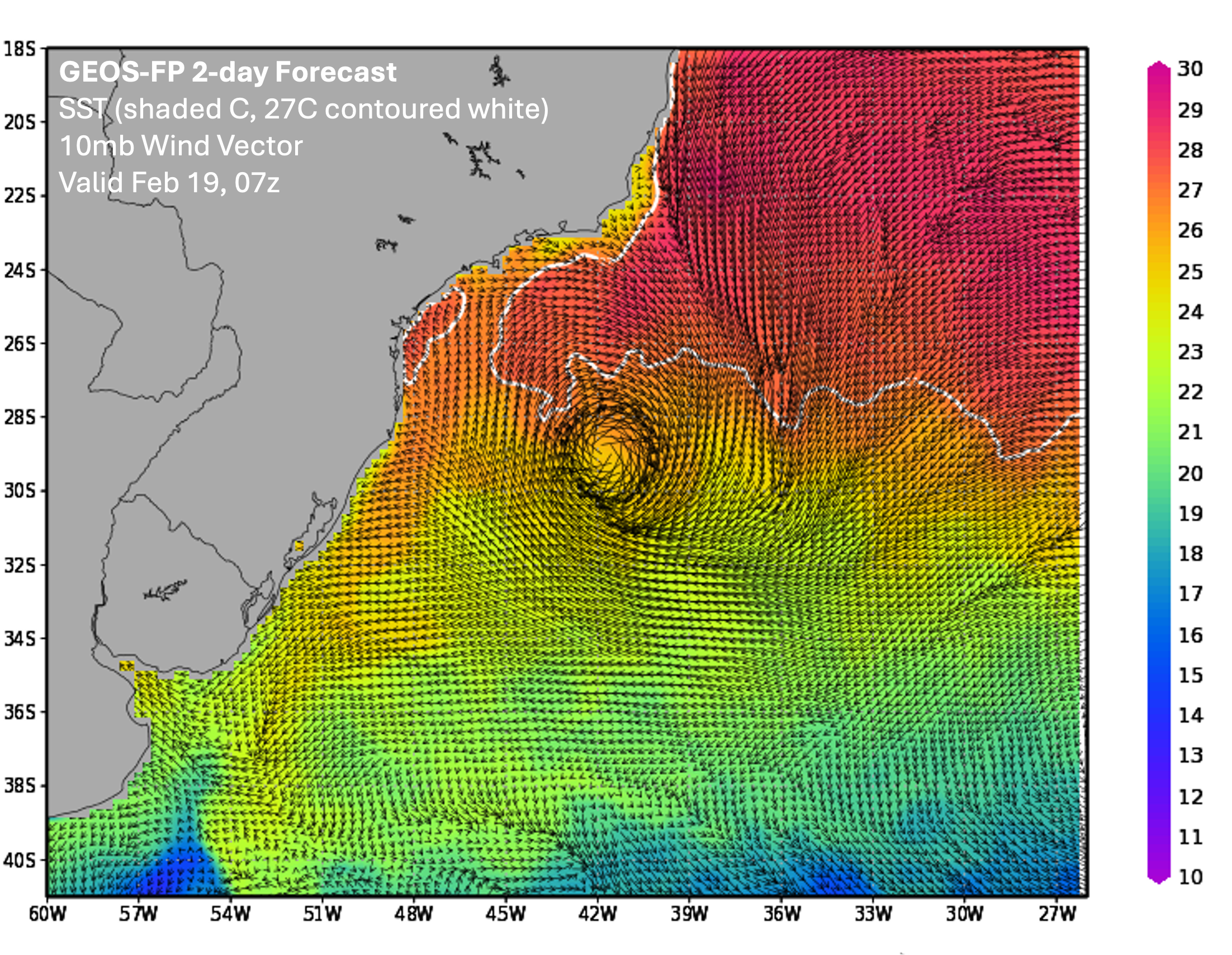
Given the name Akará by the Brazilian Navy Hydrographic Center, this tropical storm-strength cyclone did not remain symmetric and warm-cored for very long. Hours after its initial satellite presentation, the thunderstorms near its center dissipated exposing swirls of low clouds. The system then evolved towards the much more common asymmetric, cold-cored type of low-pressure. As historical context, approximately eighty tropical cyclones are known to have developed in the South Atlantic basin dating back to 1957. Thus, while relatively rare, they do occur at the rate of about one or so per year, mainly during the months of Nov. through May. The combination of cool sea surface temperatures (SST’s) and unfavorable vertical shear profiles are the primary reasons such tropical cyclones do not frequently develop in this ocean basin. In the case of Akará, SSTs were marginally warm and deep enough to initiate and sustain the thunderstorm growth necessary to trigger the tropical cyclone generation process. The larger scale meteorology indicated the presence of weak vertical wind shear in the environment of the developing tropical low-pressure promoting its generation, as well. GEOS-FP captured both the larger scale and smaller scale processes, and hence produced an accurate forecast depiction of Akará.
The most notable South Atlantic tropical cyclone in the historical period dating back several decades occurred in March 2004 with a hurricane-strength system called Catarina. With its tight radius of 50m/s (112mph) maximum winds (even displaying a clear eye on satellite images) and other signs of a symmetric, warm-core, Catarina is believed to represent the upper limit of such phenomenon. Many of the remaining eighty were far weaker than Catarina. A preliminary estimate would place Akará about midway between the weakest of this grouping and Catarina. While Akará was not responsible for any damage over land, thanks to GEOS-FP, NASA GMAO can now provide accurate forecasts for Brazil and other affected countries when these rare systems do develop.
References:
Tamizi, A., Young, I.R, Ribal, A., Alves, J-A. 2020. Global Scatterometer Observations of the Structure of Tropical Cyclone Wind Fields. Monthly Weather Review, Volume 148 Issue 11.