Lake Effect Snow in GEOS-Exp 4km Model
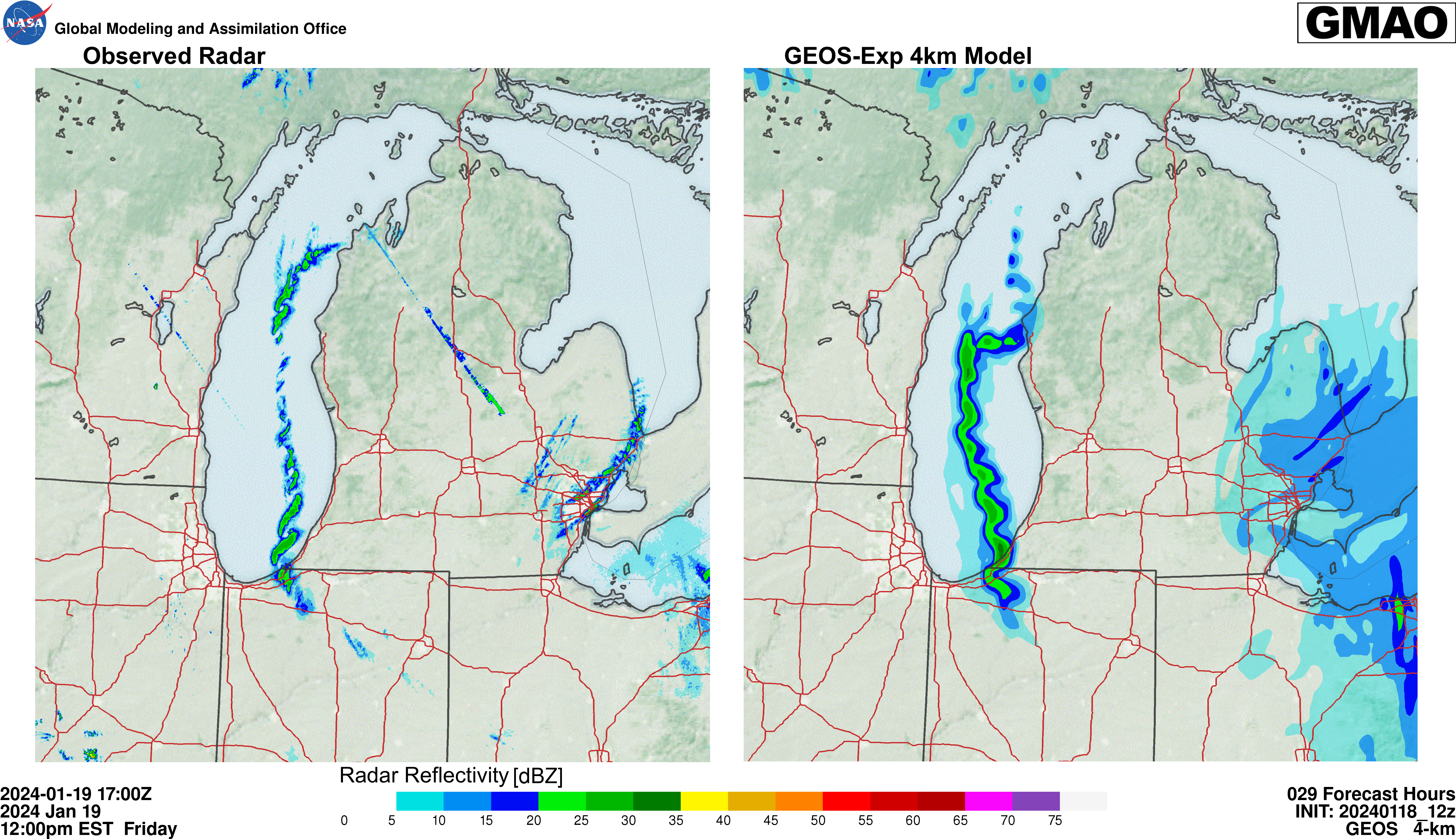
The Global Modeling and Assimilation Office’s (GMAO) experimental Goddard Earth Observing System (GEOS) 4km resolution model forecasted lake effect snow bands over Lake Michigan on January 19th, 2024. Figure 1 shows the model’s solution (right) from an initialization at 12z, January 18th – 29 hours before the observed radar reflectivity which is shown in the figure’s left panel. The location, timing, and severity of the snow squalls were resolved quite accurately, showcasing the model’s performance in high-resolution. The timelapse of the event can be seen in Animation 1.
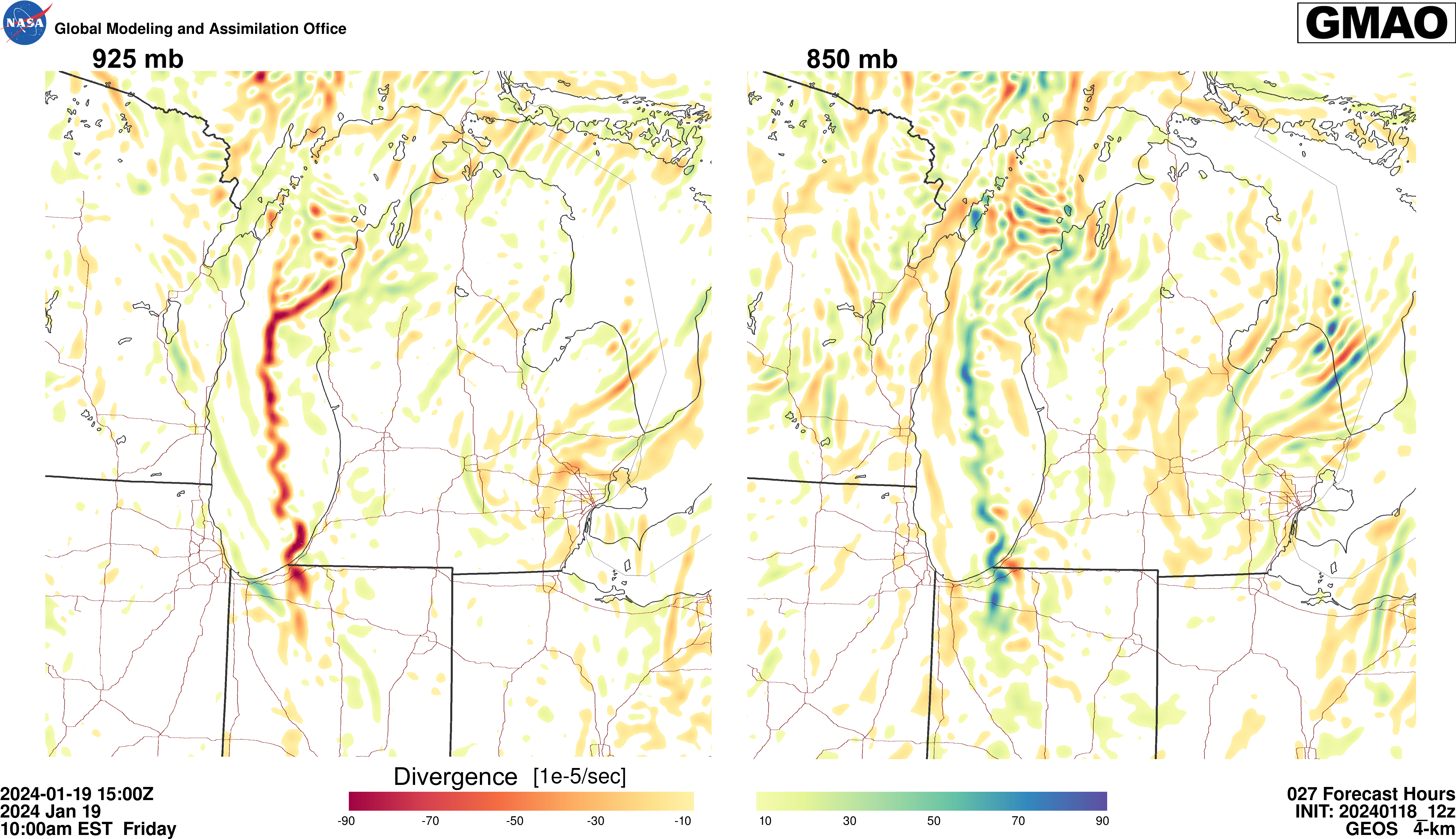
These snow squalls formed due to low-level convergence leading to divergence directly above, in a very small layer near the surface, depicted in Figure 2. There is convergence (red, negative) at 925mb, which is lifting the air to the divergence (blue, positive) at 850mb. This happening over the anomalously warm, ice-free waters of Lake Michigan, leading to the snow squalls. There is some horizontal shear in this set up as well, creating the vortices depicted in Animations 2 and 3.
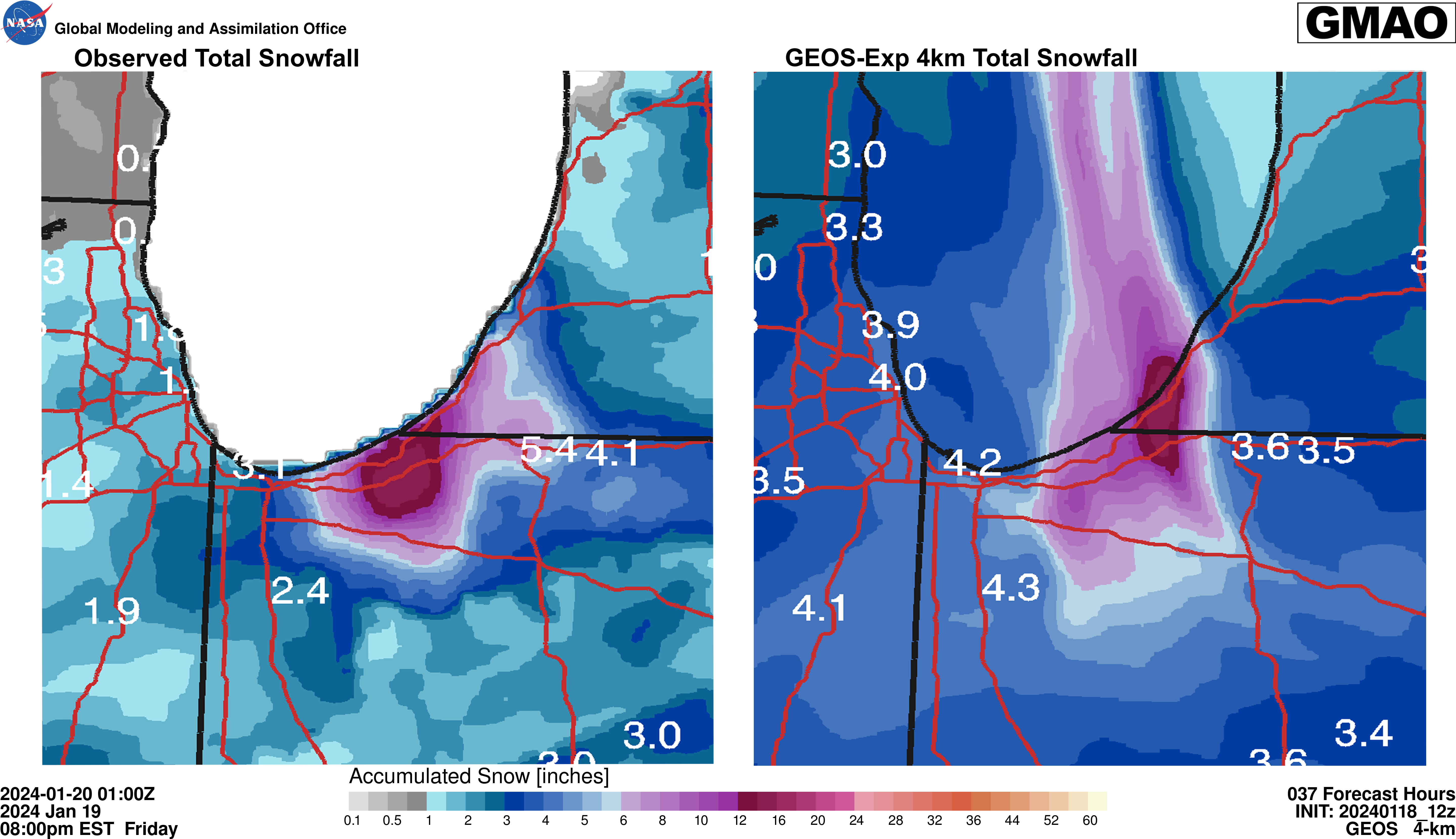
The GEOS-Exp 4km model output was also accurate in the total snowfall of this event. It is seen in Figure 3 that the forecast of the model (right panel) were accurate in both location and magnitude (left panel) that snow that fell.