A Tale of Two Blizzards
A blizzard is a particular type of winter storm which, by definition, combines elements of snow and high wind (35mph sustained, or more) to cause severely restricted visibility below one-quarter of a mile for a period of three consecutive hours, or more. The element of snow may arise from precipitating clouds, by previously fallen ground snow being blown and drifted, or a combination of both. in cases where the necessary elements of a blizzard are met with little or no precipitating snow, the term ground blizzard may be also be used.
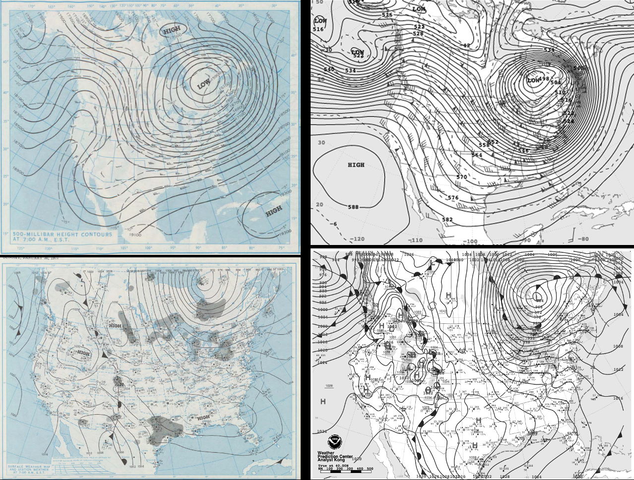
Much like each hurricane has some unique identifying characteristics distinguishing one from another, so too can blizzards. That may be said about two legendary blizzards which severely impacted western New York, and more specifically the Buffalo metro region. Long-time residents of this area often cite the Blizzard of 1977 as the benchmark event by which they compare all others. That is, until the December 2022 blizzard struck this area—rendering the city paralyzed and claiming even more lives than its 1977 predecessor. The area of western New York downwind of Lake Erie is certainly no stranger to frequent and sometimes intense periods of lake effect or lake enhanced snow. However, the wind and/or visibility elements typically fall short of reaching blizzard criteria. Even when these conditions are technically met, they often develop and remain in narrow bands about 10-20 miles south of the more densely populated Buffalo metro region.
However, in the 1977 and 2022 historic Buffalo winter storms, the synoptic meteorology was nearly idealized to place the city in the cross-hairs for consecutive days of true blizzard conditions. Even with the large-scale meteorology similarities, there was an interesting notable difference even among the two historic blizzards. In the 1977 storm, Lake Erie was already frozen over before the event unfolded (January 28-February 2, 1977). In general, after the freezing up of Lake Erie, lake effect and lake enhanced snow bands developing downwind are either dramatically reduced or ended . The multi-day blizzard conditions arose in large part by near-hurricane force winds picking up previously fallen snow on the frozen lake and blowing and drifting it back onto the land, with some modest large-scale snowfall. The recent blizzard (December 23-27, 2022) occurred prior to any ice forming on Lake Erie. This storm’s near-hurricane force winds over the open lake triggered significantly more snowfall in this blizzard. Regardless of the details, the end result in both was to unleash a long period of disorienting blizzard conditions leaving Buffalo and its surrounds under snow drifts—30 feet or more in places, and a period of difficult rescue and post-storm recovery.