Less than one month after severe flooding, another series of North Pacific cyclones carried a wave of tropical moisture into California with similar consequences. Unlike the first event, these cyclones rode up and over a blocking high pressure system and traversed the West Coast of the United States from north to south. This track entrained colder air and resulted in snowfall amounts not seen in decades. Atmospheric rivers played a significant role once again as tropical moisture flows north then south around the blocking high pressure system forming a giant river bend. Atmospheric rivers have supplied enough moisture over the past 2-3 months to eradicate most of the California drought conditions that have persisted since 2020.
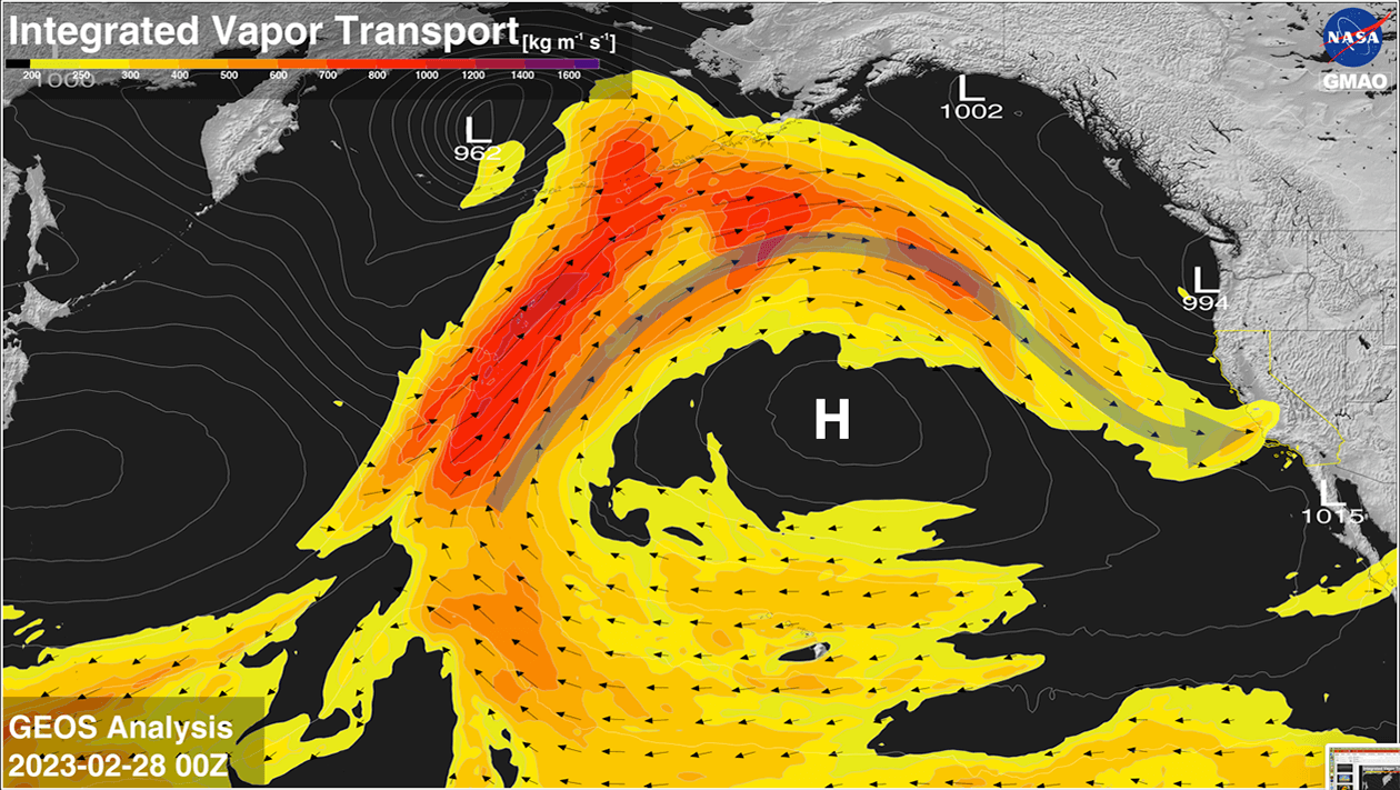
Integrated vapor transport (IVT) shows the tropical origins of the atmospheric river. The moisture takes a circuitous maritime route over the blocking high pressure system (“H”) as a series of coastal cyclones (“L”) inundate California with heavy rain and snow. Sea level pressure is shown as contours with local minima in units of mb.
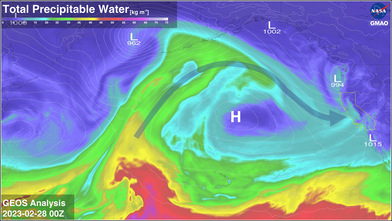
A series of North Pacific cyclones transport tropical moisture up and over a blocking high pressure system forming an atmospheric river bend. This river supplies copious amounts of precipitable water (TPW) that inundates California and the West Coast of the United States with each passing storm. Sea level pressure is shown as contours with local minima in units of mb. [Movie]
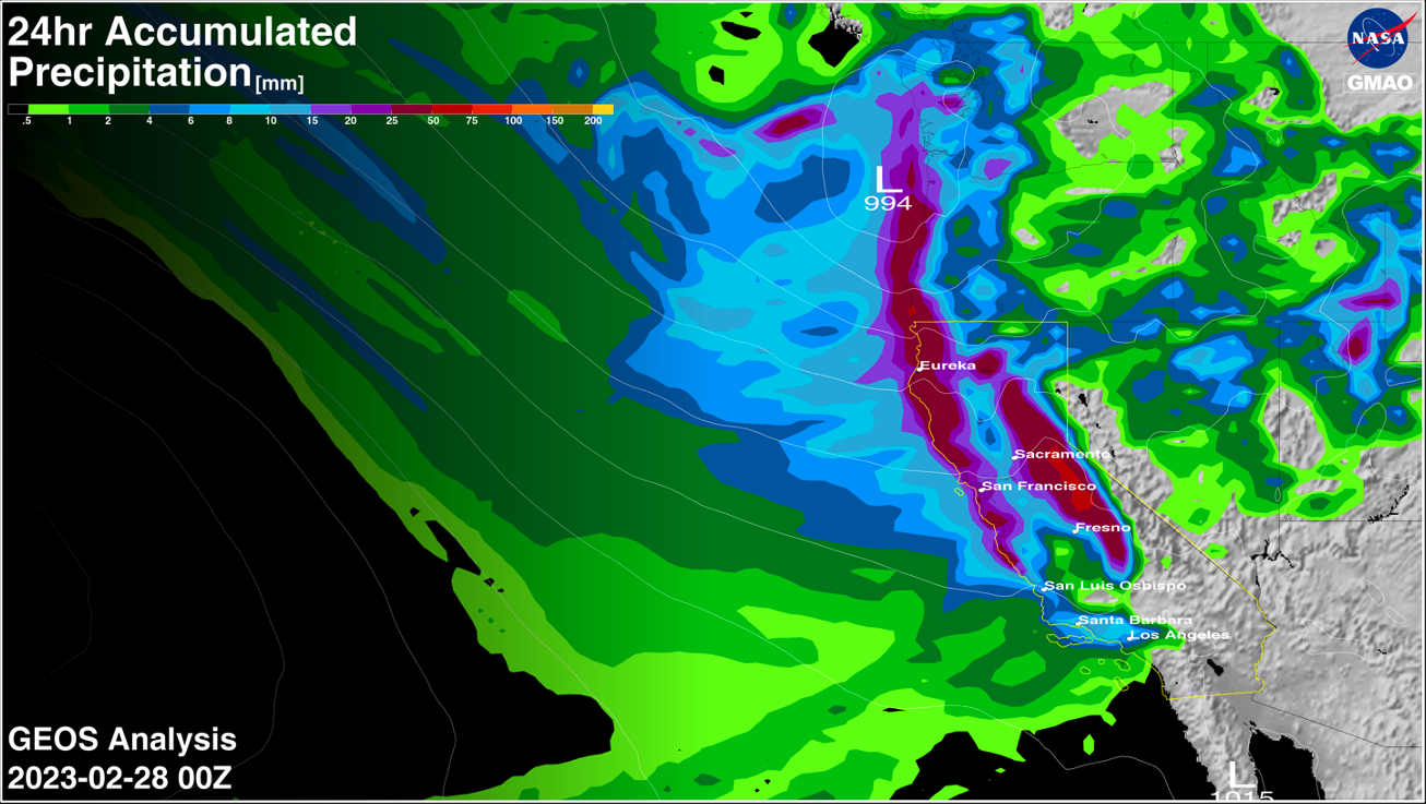
24-hour accumulated precipitation showing heavy precipitation along the West Coast and mountains of California as storms move north to south along the coast. Each passing storm carries abundant tropical moisture supplied by atmospheric river currents with fetches that traverse the entire North Pacific ocean basin. Sea level pressure is shown as contours with local minima in units of mb.
[Movie]