

Rare Atmospheric River Caused Record Floods Across the Middle East
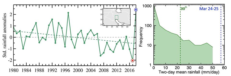
Record rainfall in late March 2019 led to unprecedented flooding across several Middle Eastern countries and caused enormous damages and casualties, particularly in Iran. The intense rains have made the 2018/19 rainy season (October–March) the wettest in the past four decades, a sharp contrast with the prior year, which was the driest over the same period. Thus, this event is an example of rapid dry-to-wet transitions and intensification of extremes, potentially resulting from climate change.
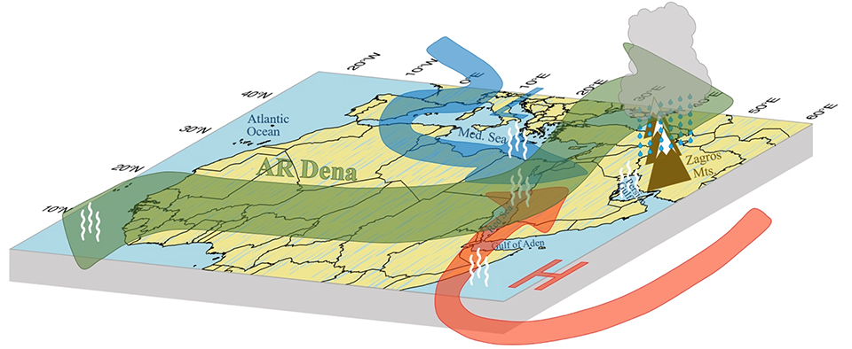
An atmospheric river (AR), originating in the tropical Atlantic Ocean, was found to be responsible for the heavy precipitation that initiated the floods. Some areas received ~400 mm rainfall during this AR. Vertically integrated water vapor transport (IVT) from MERRA-2 data is used to identify the AR. To easily distinguish it from similar large-magnitude events over the region, here this AR is named “Dena,” after the peak of the Zagros Mountains, which played a crucial role in precipitation formation. Moisture transport by AR Dena was equivalent to more than 150 times the aggregated flow of the four major rivers in the region, that is, the Tigris, Euphrates, Karun, and Karkheh.
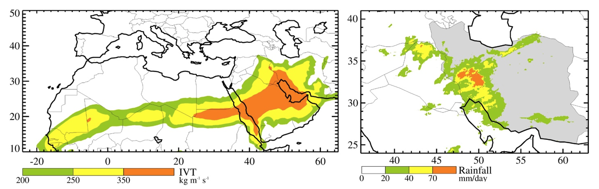
An AR of this magnitude can be pretty rare for the Middle East. Specific synoptic weather conditions, including tropical–extratropical interactions of the atmospheric jets, and anomalously warm sea surface temperatures in all surrounding basins, provided the necessary ingredients for formation of such a massive AR. Such conditions facilitated additional moisture transport from the Mediterranean, Arabian Sea, Gulf of Aden, Red Sea and Persian Gulf toward the AR.
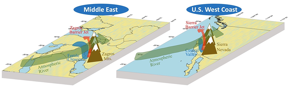
It is intriguing to show that the impacts of ARs are not limited to the coastal regions like the U.S. West Coast. Such ARs can travel long distances away from the oceans and affect remote arid and semi-arid regions like the Middle East. In fact, these two regions bear some geographical similarities, including their latitudinal extent, presence of a southeast–northwest-oriented mountain range overlooking a fertile plain and the associated low-level barrier jets.
Reference:
Dezfuli, A., 2020. Rare atmospheric river caused record floods across the Middle East. Bulletin of the American Meteorological Society, 101(4), pp.E394-E400. DOI:10.1175/BAMS-D-19-0247.1.