

MERRA: MODERN-ERA RETROSPECTIVE ANALYSIS FOR RESEARCH AND APPLICATIONS
Time Variations of Precipitation in Reanalyses Precipitation Variations:
|
|
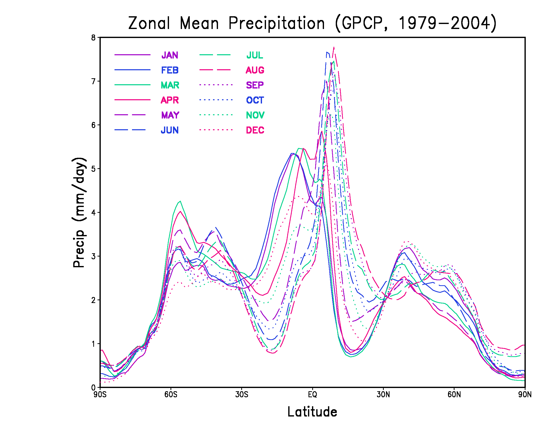
The placeholder image overlaps 12 curves showing the GPCP climatology of the Zonal Mean Precipitation for each month of the year. The zonal mean profile is a plot of the meridional mean precipitation rate (mm/day) versus latitude. Each curve is an average over the 26 years from 1979 through 2004. Click on the browser refresh button to view this again.
The 12 buttons on the right side lead to climatology comparisons of the
Monthly Zonal Mean Precipitation averaged over the 22 years from 1979 through 2000.
The five data sets compared are
GEOS4-CERES (purple), NCEP-R2 (JRA-25orange), and GPCP (magenta).
|
JAN
FEB
MAR
APR
MAY
JUN
JUL
AUG
SEP
OCT
NOV
DEC
|
Precipitation Variations:
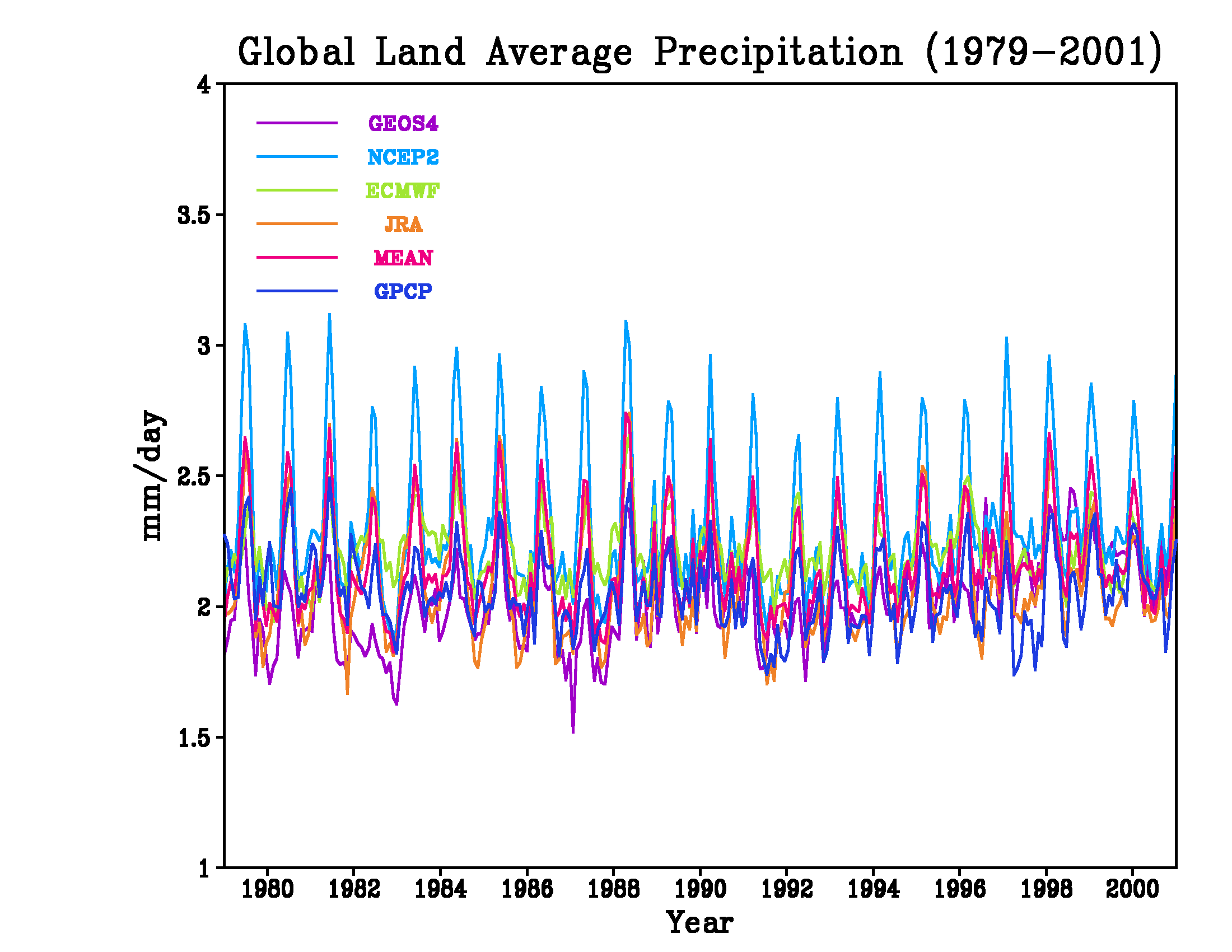
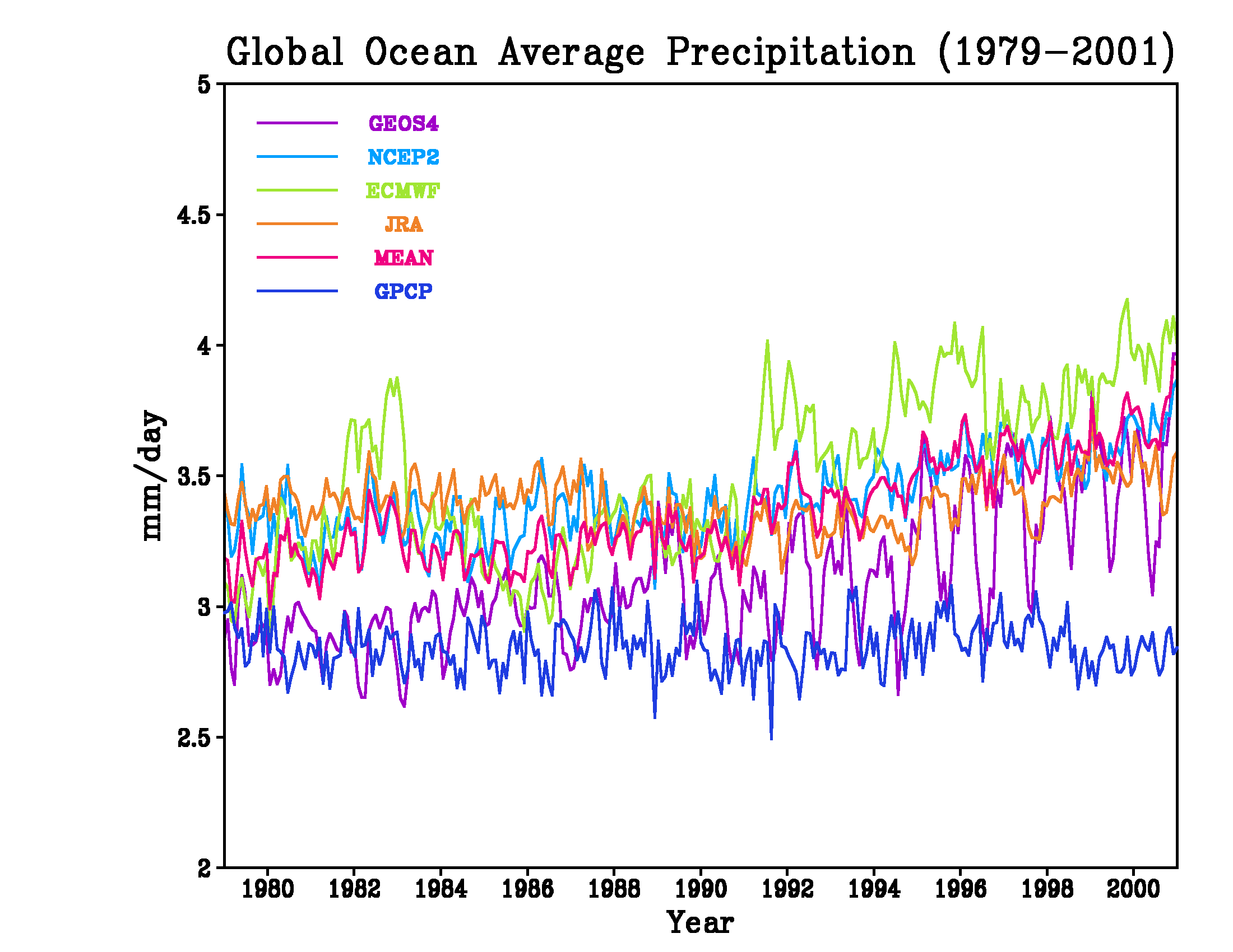
Time Series of Global Average -versus- GPCP
| The Global Precipitation Climatology Project (GPCP) is a data set produced by the international GEWEX program which contains monthly averaged precipitation rates (mm/day) for the time period Jan 1979 through the present. The GPCP data set combines satellite and gauge measurements of precipitation. The GPCP Version 2 documentation explains that the data are merged at the NASA GSFC Laboratory of Atmospheres and includes rain gauges, GPI, OPI, SSM/I scattering, SSM/I emission, and TOVS. |
|
These images are time series of the monthly mean precipitation from 1979 to 2001. The top series covers the entire globe, whereas the second row compares means over land (left) versus ocean (right). The compared data sets are GEOS4-CERES (purple), NCEP-R2 (cyan), ERA-40 (green), JRA-25 (orange), and GPCP (blue). The time series also include a MEAN (magenta) of the four analysis systems. Click on any image to expand it in a separate window. Note that in 1987, at the same time as the introduction of SSM/I data, the GEOS4 reanalysis shifts away from following GPCP and becomes more like the other reanalyses 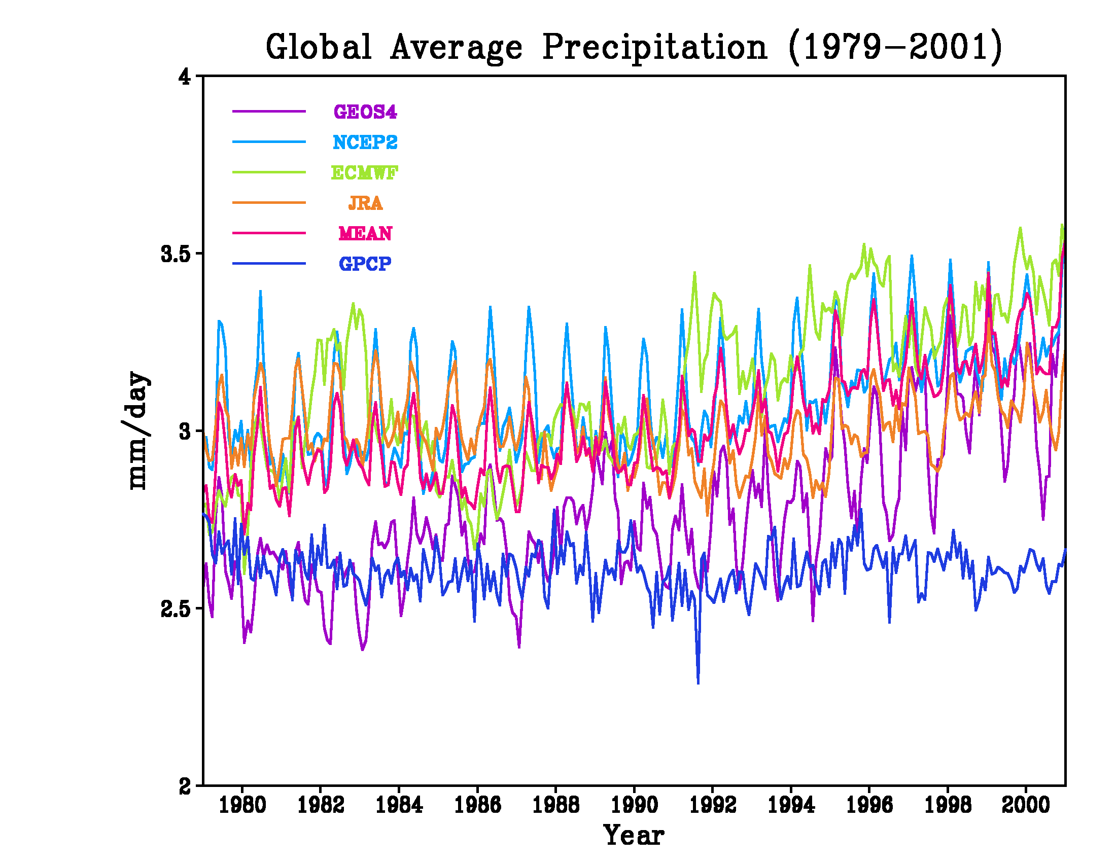
|
|
|
Precipitation Variations:
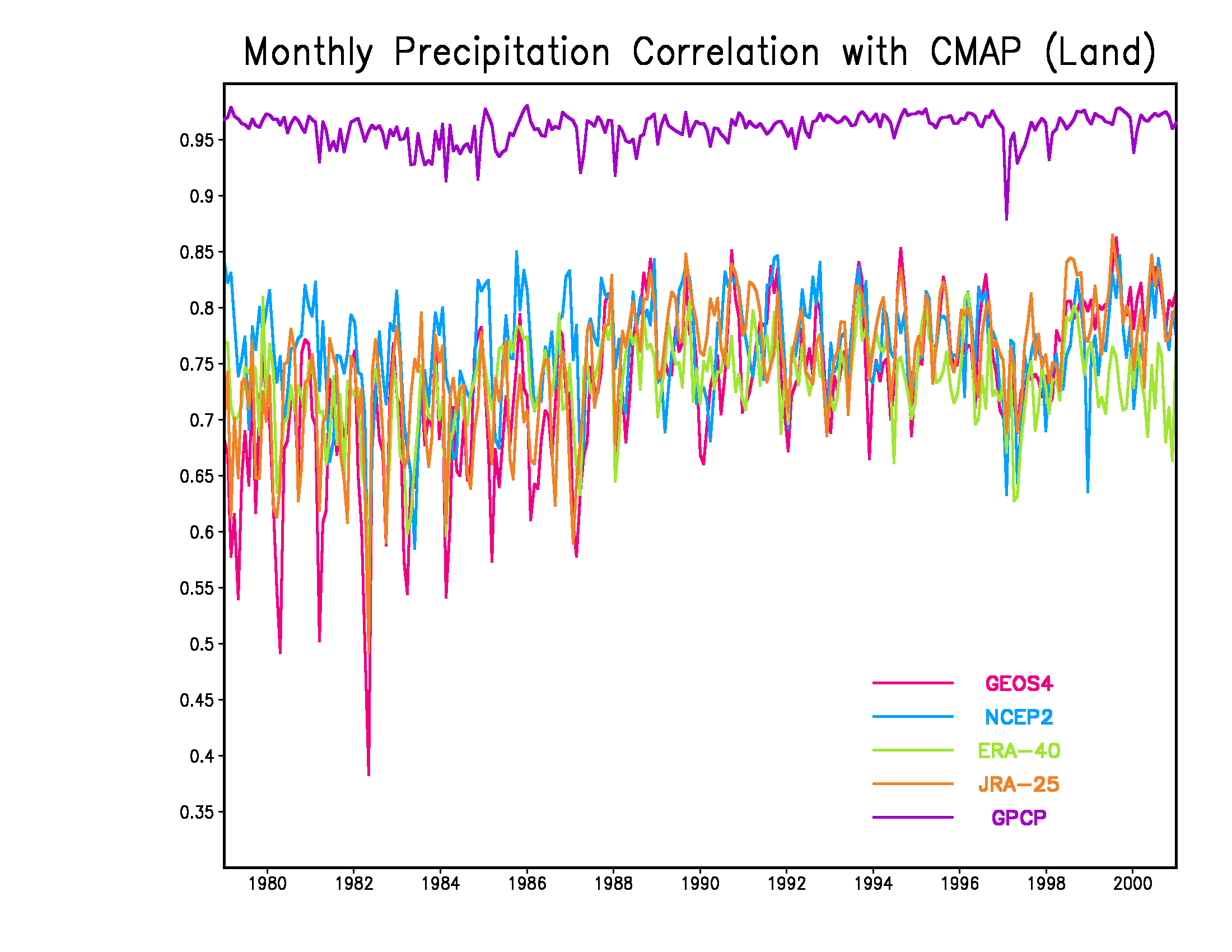
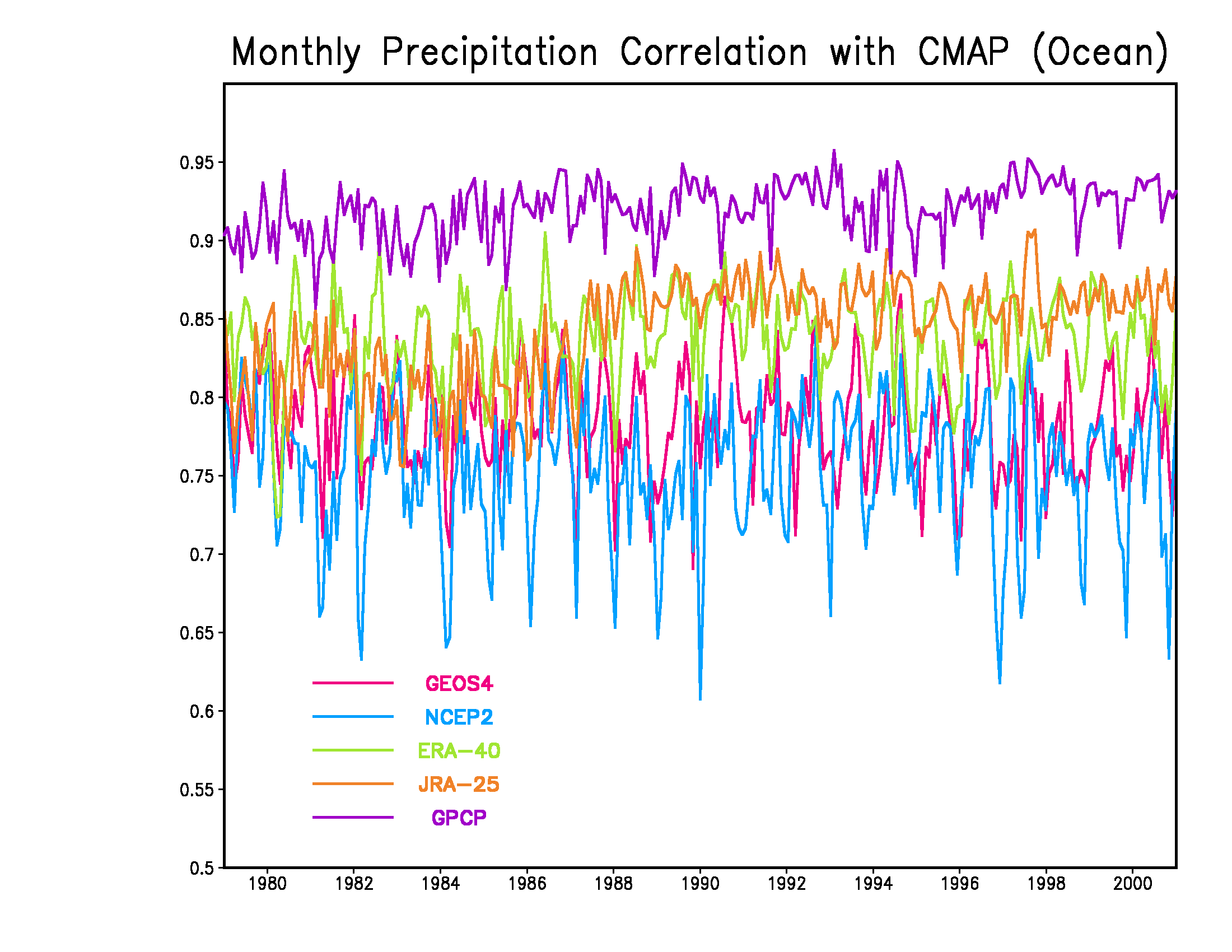
Correlation of Monthly Mean -versus- CMAP
| The CPC Merged Analysis of Precipitation (CMAP) is a data set produced by NOAA which contains monthly averaged precipitation rates (mm/day) for the time period Jan 1979 to Aug 2005. The standard data set incorporates 5 satellite measurements of precipitation: GPI, OPI, SSM/I scattering, SSM/I emission, and MSU. Note that the primary differences between CMAP and GPCP are that GPCP includes rain gauge measurements and treats TOVS data differently. The enhanced CMAP data set also includes NCEP reanalysis data. |
|
These images are time series of the correlation between monthly means of precipitation against CMAP from 1979 to 2001. The top series covers the entire globe, whereas the second row compares means over land (left) versus ocean (right). The compared data sets are GEOS4-CERES (magenta), NCEP-R2 (cyan), ERA-40 (green), and JRA-25 (orange). Also plotted is the correlation between GPCP (purple) and CMAP, which not surprisingly is very high. Click on any image to expand it in a separate window. Note that in 1987, at the same time as the introduction of SSM/I data, the JRA-25 reanalysis shifts to and maintains a closer correlation with CMAP. 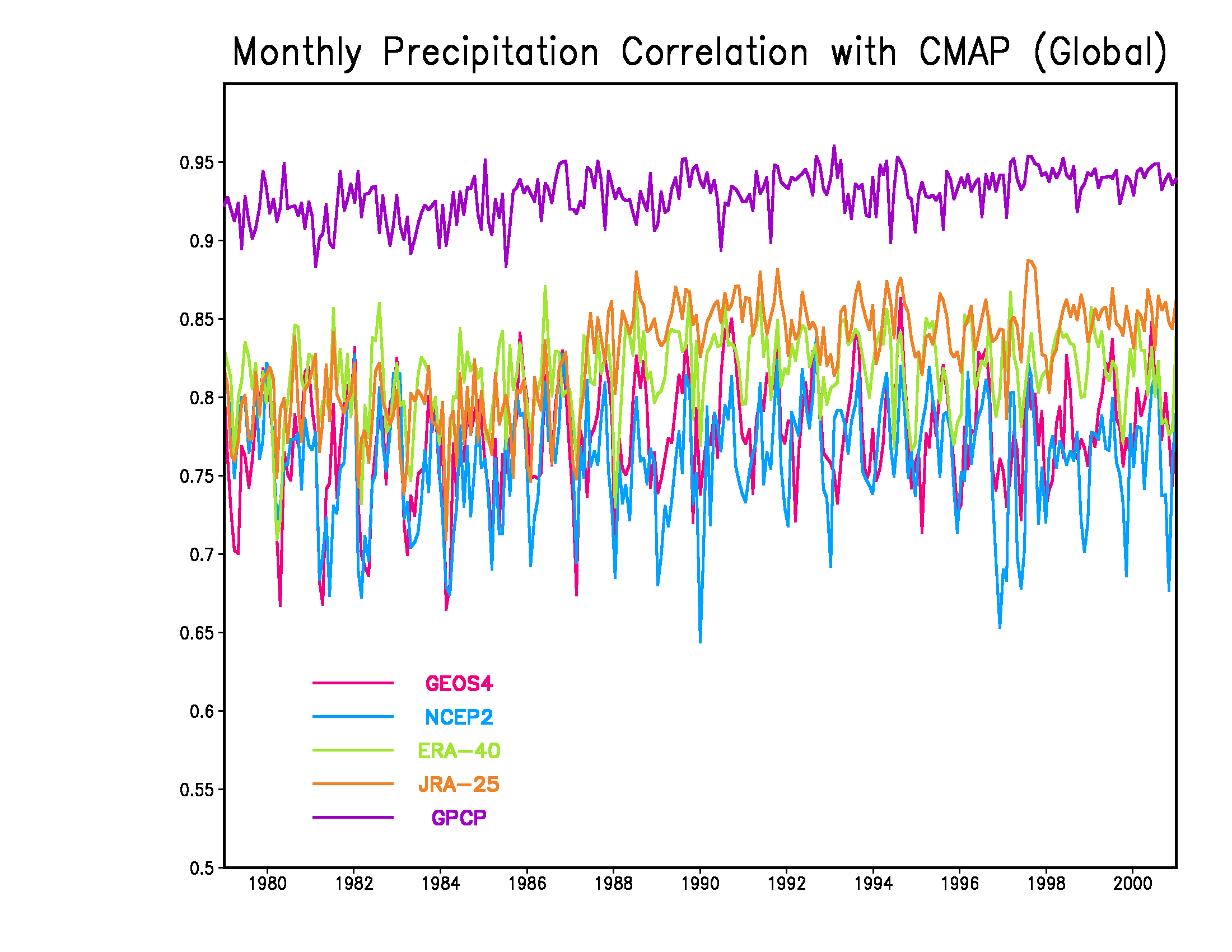
|
|
|
GMAO Website Curator: Kaushal Patel |